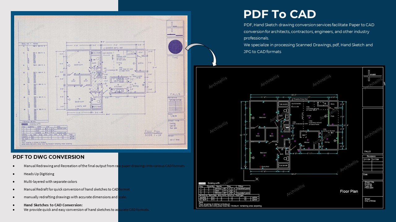
PDF / Hand sketches to CAD" is a service or process that involves converting hand-drawn sketches or PDF files into digital Computer-Aided Design (CAD) format. This service is commonly used in various industries such as architecture, engineering, construction, manufacturing, and product design
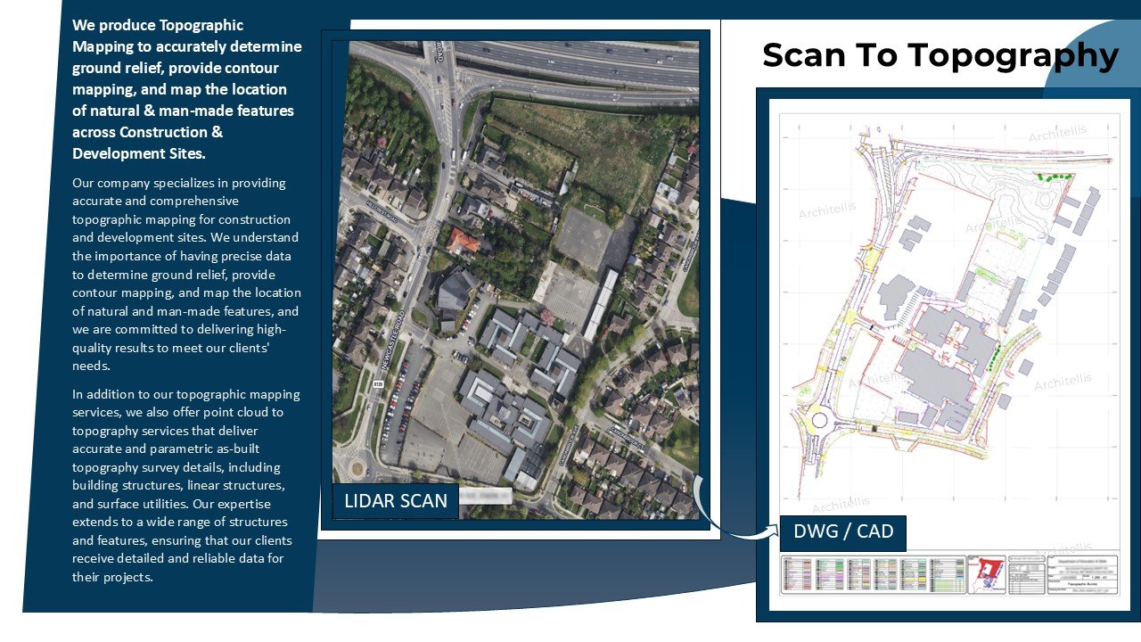
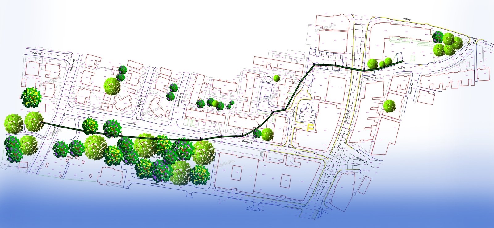
Point Cloud to Topography Services delivers accurate and parametric As-Built Topography Survey Details Including the Building Structures: Commercial, Residents, Sheds, Garages, Barns, Screen Porches, Gazebos, Street Light Poles, Pools, Sign Boards, Manholes, Catch Basin, Driveways, Pavement, Curbs Stone, Gravel Areas, Concrete pads, Patios, Parking Areas, Lawns, Tree lines and any other linear Fences, Walls, Contours.
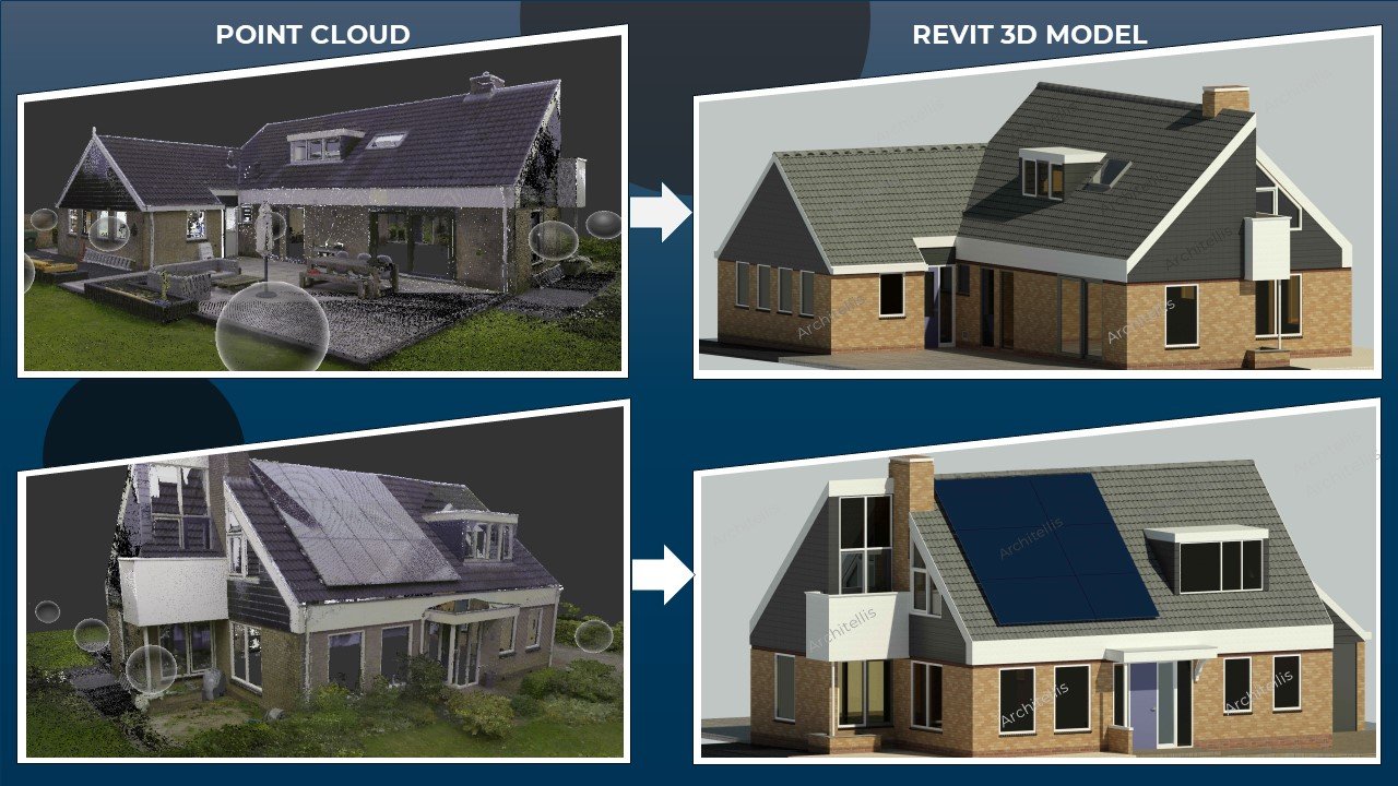
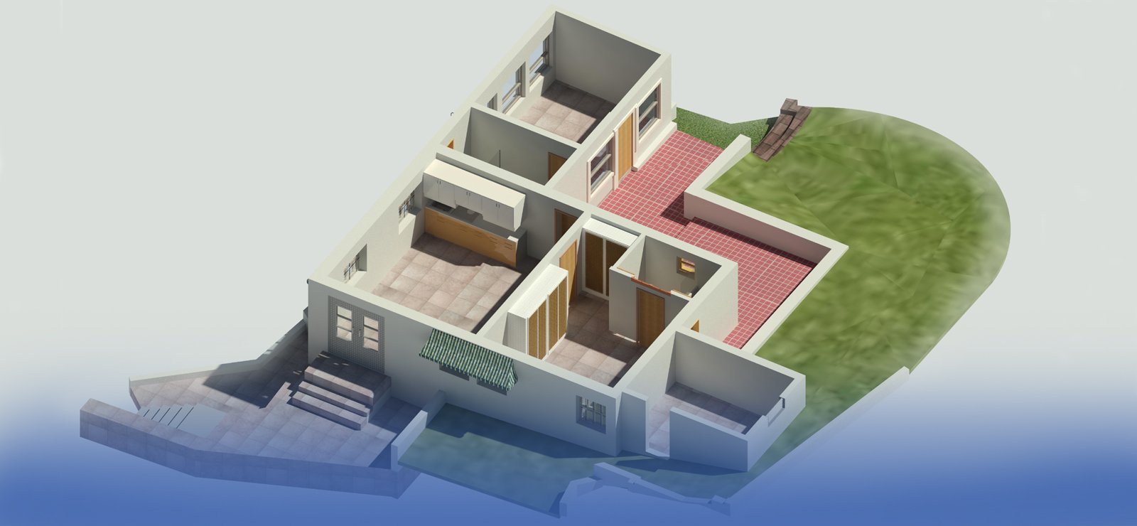
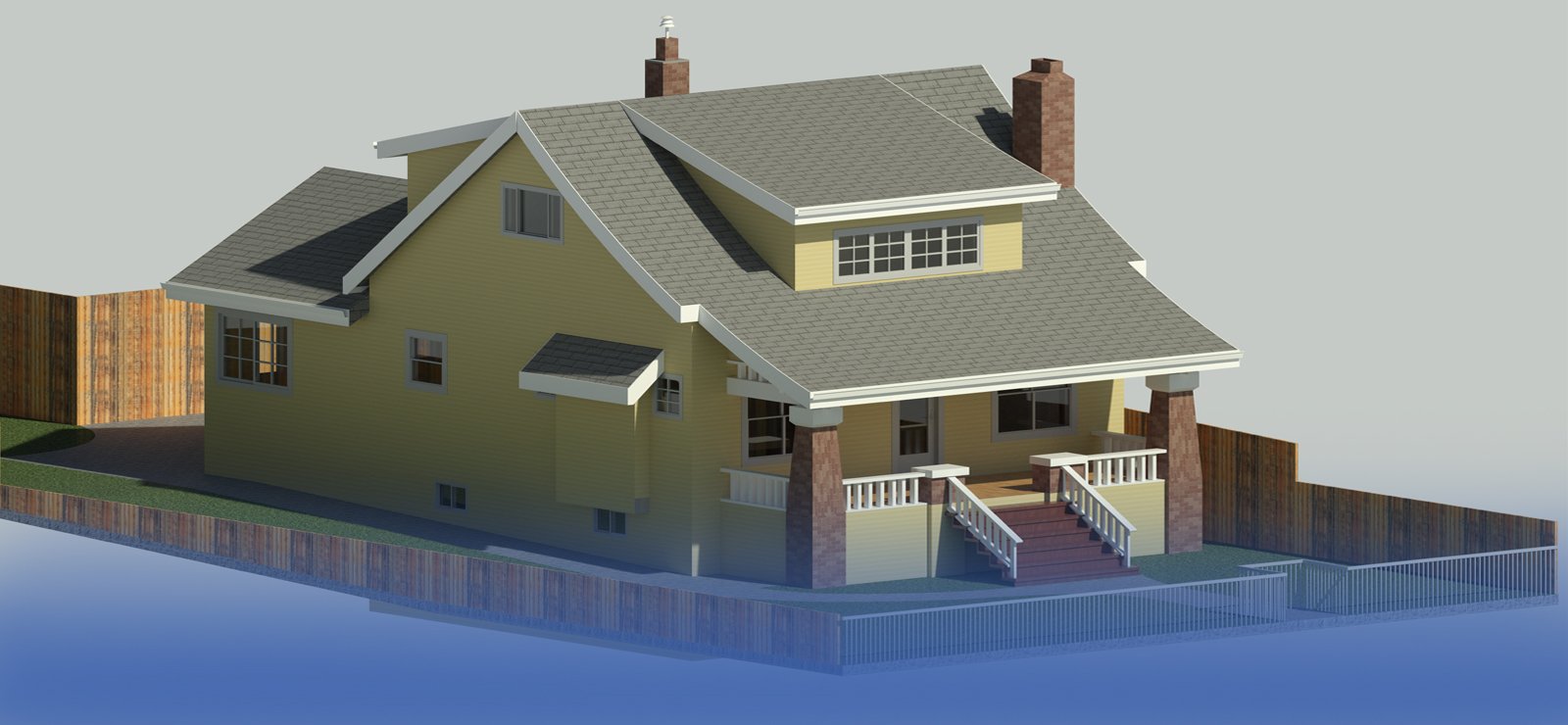
Scan to BIM" is a process used in the architecture, engineering, and construction (AEC) industry to convert point cloud data obtained from 3D laser scanning into Building Information Modeling (BIM) models. This process involves capturing accurate measurements of existing buildings or structures using laser scanners and then using specialized software to create intelligent 3D models.
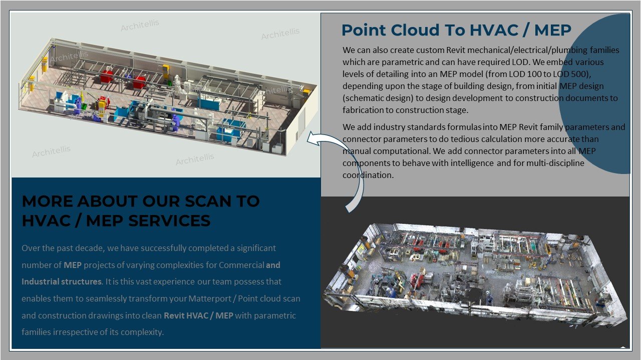
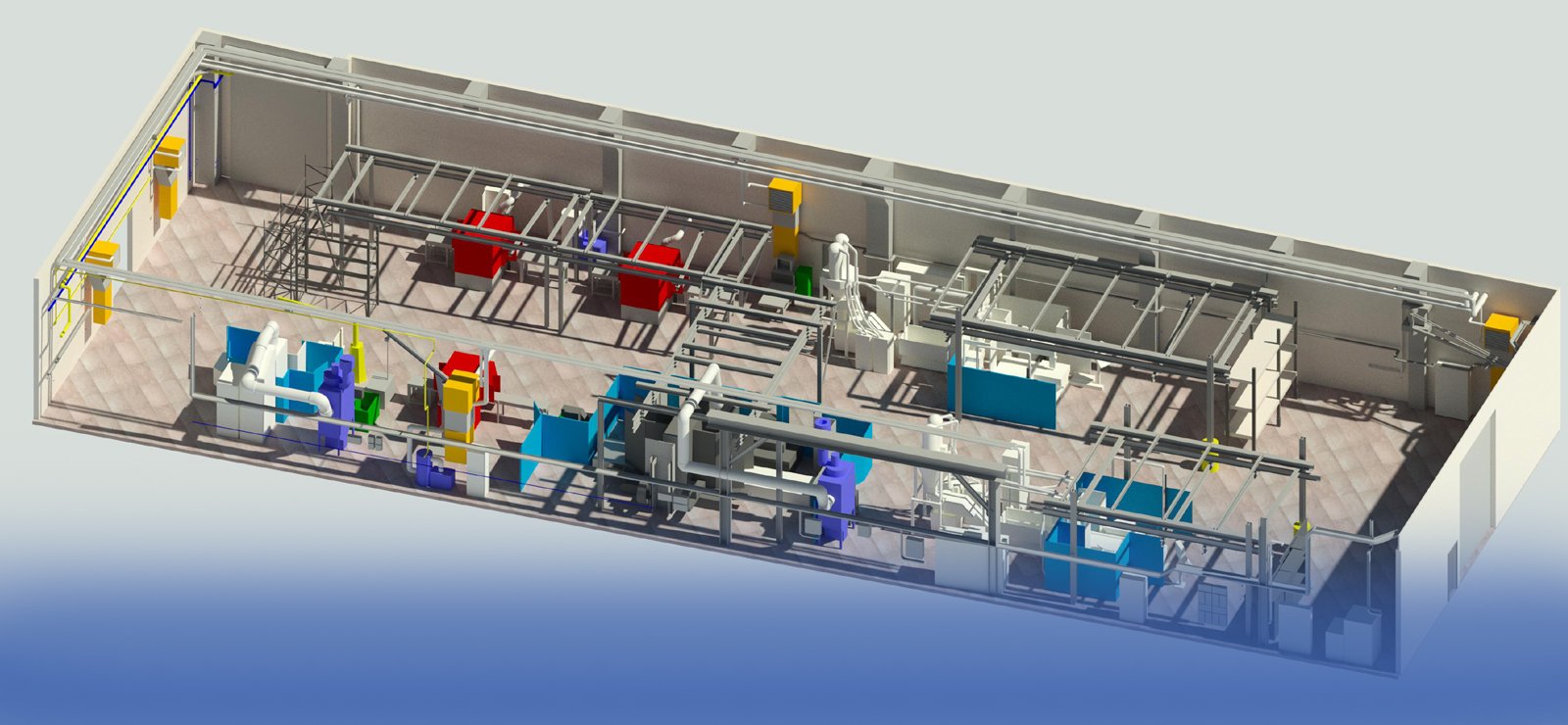
Scan to MEP" refers to the process of using 3D laser scanning technology to capture detailed as-built information of mechanical, electrical, and plumbing (MEP) systems within a building or facility, and then integrating this data into Building Information Modeling (BIM) software to create accurate and comprehensive digital representations.
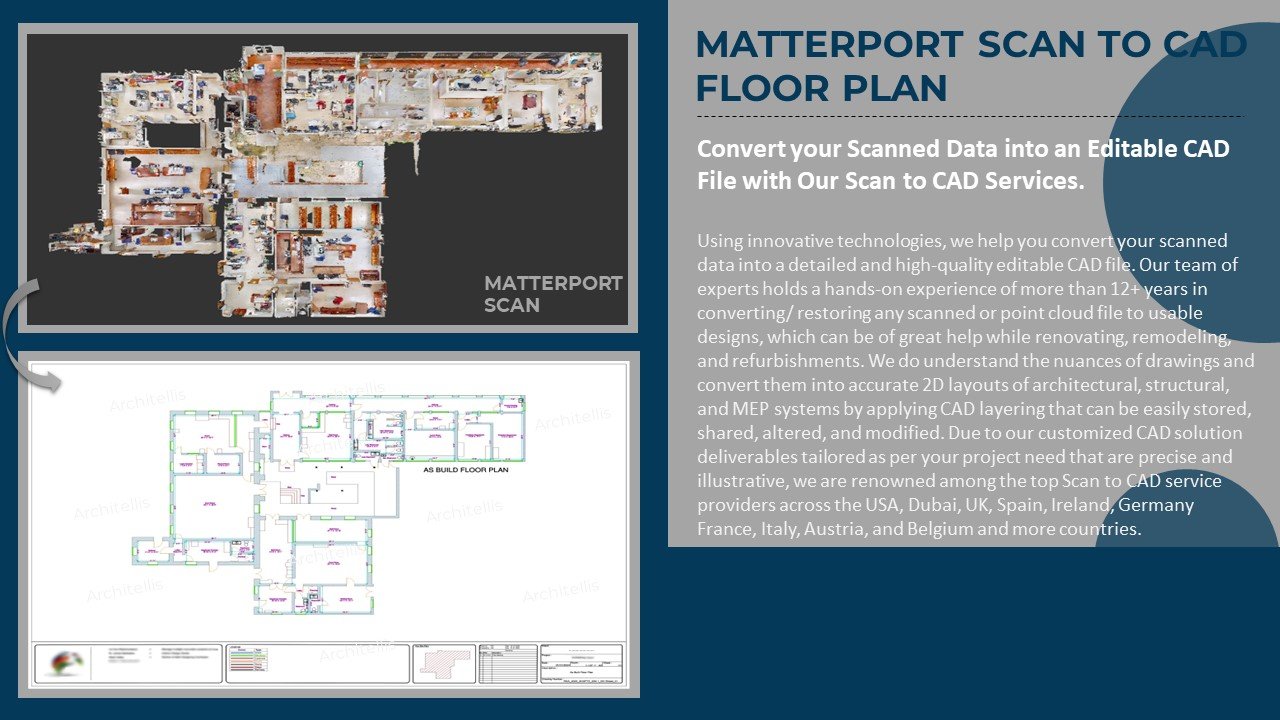
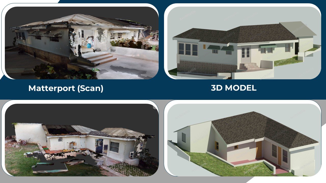
Matterport Scan to 2D & 3D" refers to the process of using Matterport's 3D scanning technology to capture spatial data of real-world environments and then converting this data into both 2D and 3D representations. Matterport is a leading provider of 3D scanning solutions that allow users to create immersive digital twins of physical spaces.
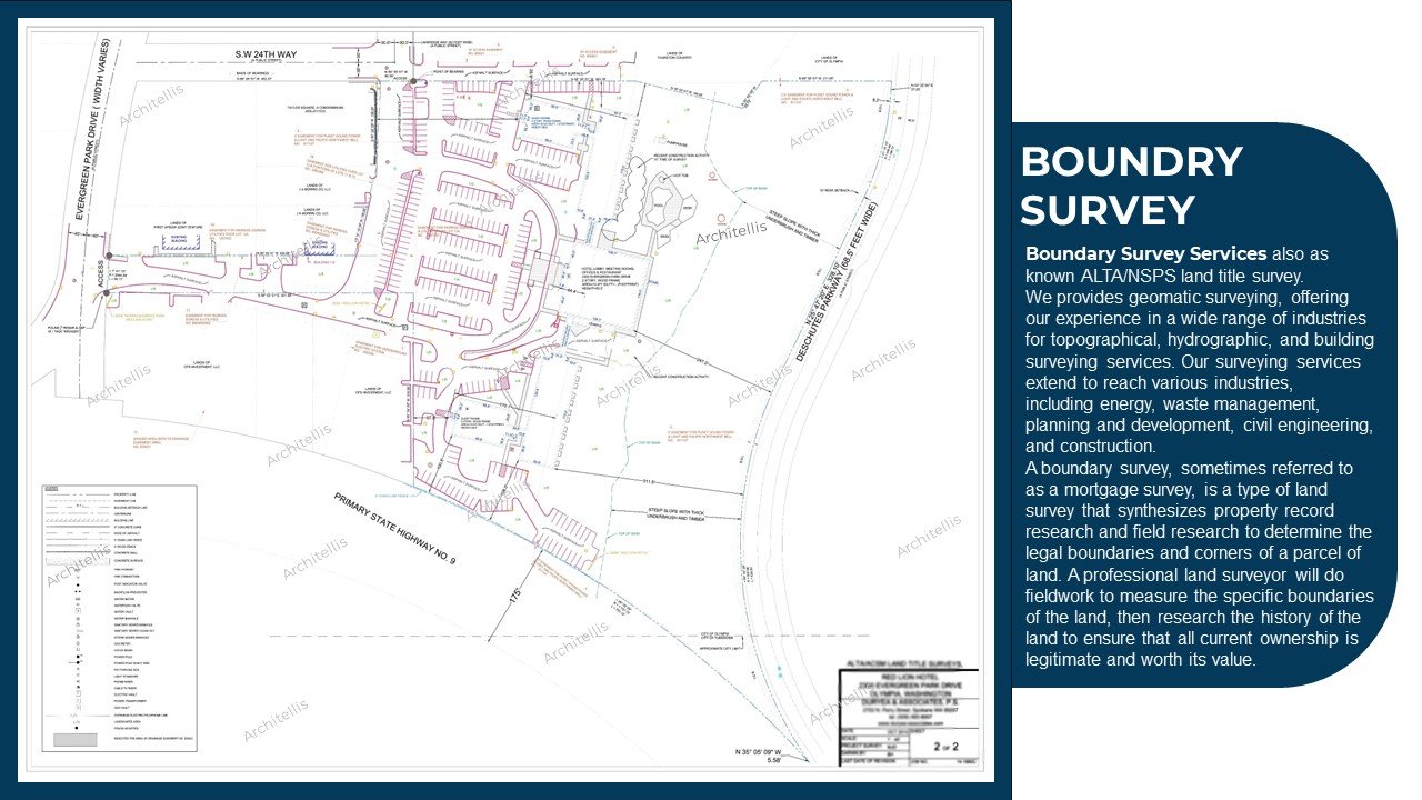
Our Point Cloud to Boundry Survey delivers accurate and parametric As-Built Boundry Survey Details Including the Building Structures: Commercial, Residents, Sheds, Garages, Barns, Screen Porches, Gazebos, Street Light Poles, Pools, Sign Boards, Manholes, Catch Basin, Driveways, Pavement, Curbs Stone, Gravel Areas, Concrete pads, Patios, Parking Areas, Lawns, Tree lines and any other linear Fences, Walls, Contours.
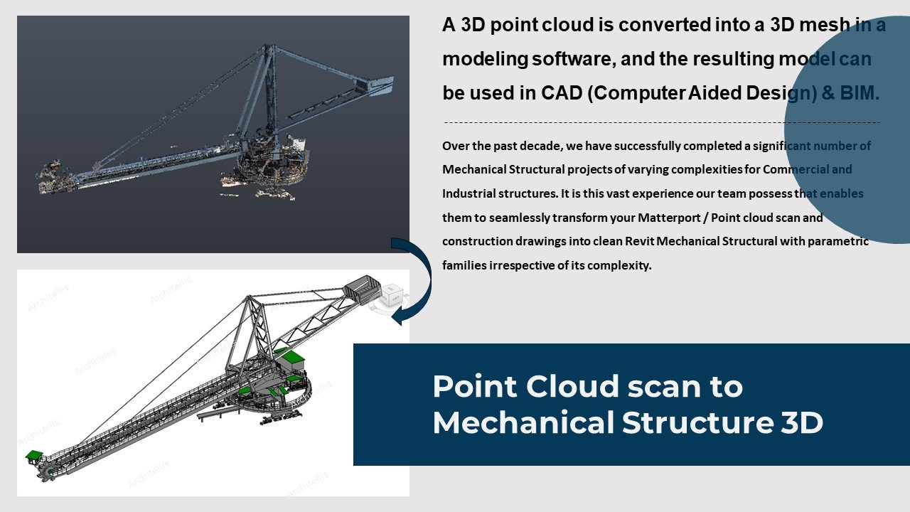
Point cloud files are powerful way to store and use spatial data for 3D modelling.
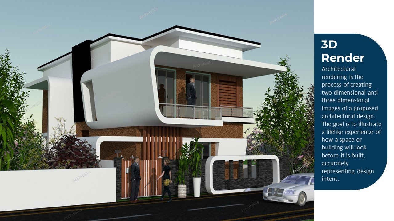
Architectural rendering is the process of creating two-dimensional and three-dimensional images of a proposed architectural design. The goal is to illustrate a lifelike experience of how a space or building will look before it is built, accurately representing design intent
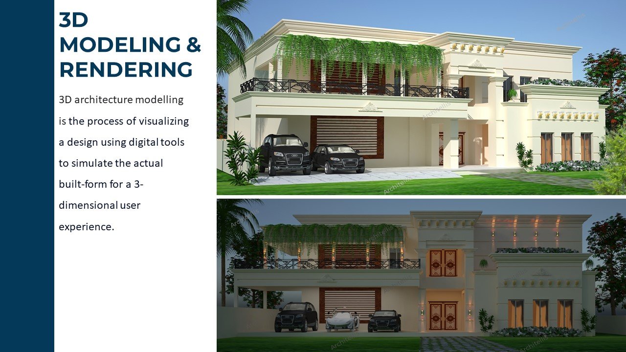
3D architecture modelling is the process of visualizing a design using digital tools to simulate the actual built-form for a 3 dimensional user experience
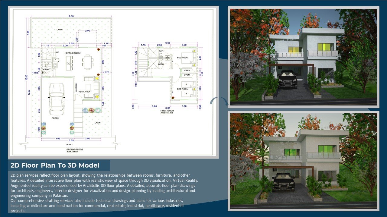
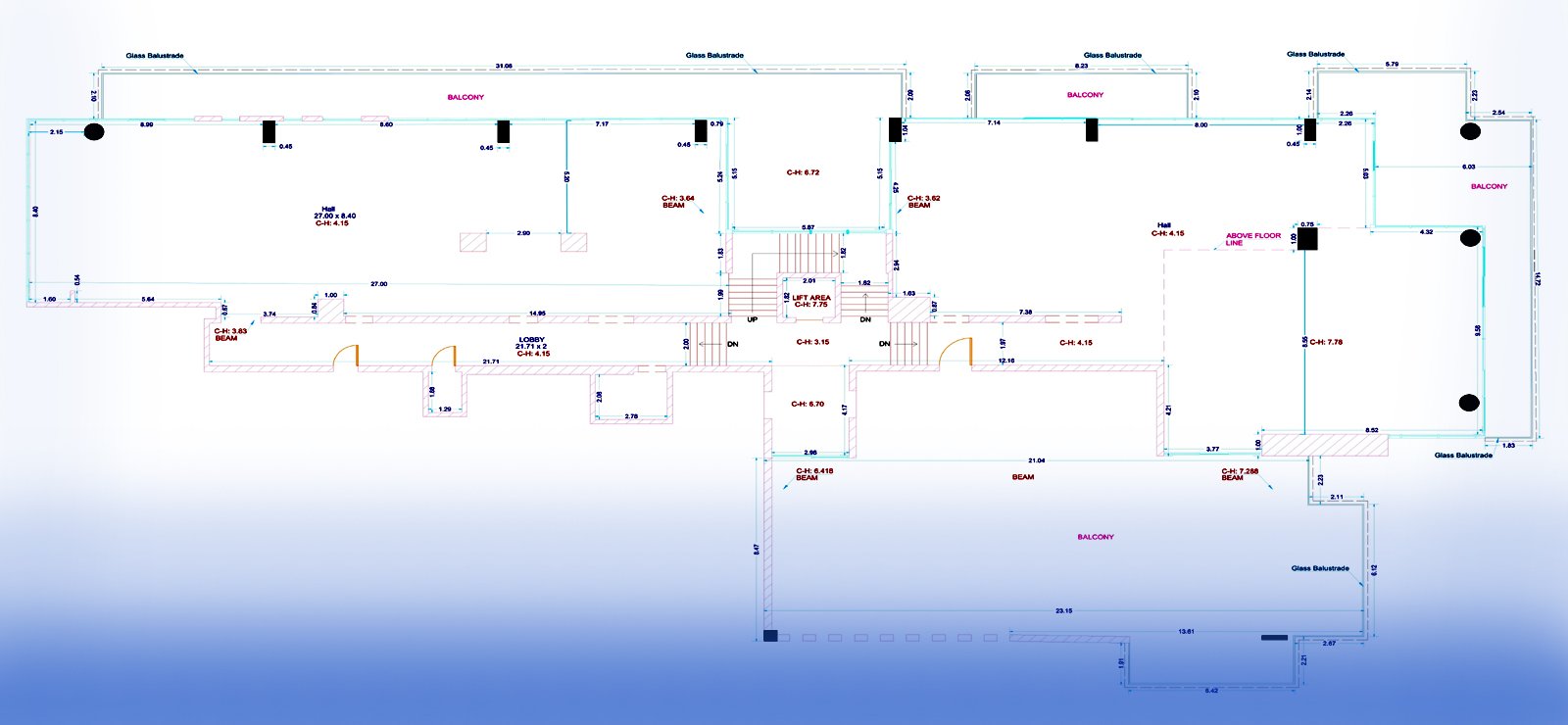
2D plan services reflect floor plan layout, showing the relationships between rooms, furniture, and other features. A detailed interactive floor plan with a realistic view of space through 3D visualization, Virtual Reality, and Augmented reality can be experienced by Architellis 3D floor plans. detailed, accurate floor plan drawings for architects, engineers, and interior designers for visualization and design planning by a leading architectural and engineering company in Pakistan. Our comprehensive drafting services also include technical drawings and plans for various industries, including architecture and construction for commercial, real estate, industrial, healthcare, and residential projects
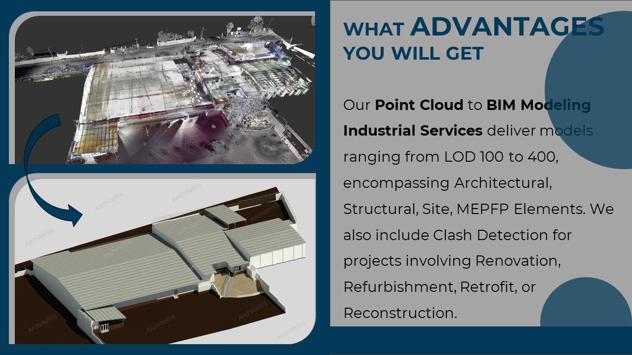
Our Point Cloud to BIM Modeling Industrial Services delivers models ranging from LOD 100 to 400, encompassing Architectural, Structural, Site, MEPFP Elements. We also include Clash Detection for projects involving Renovation, Refurbishment, Retrofit, or Reconstruction
Our as-built point cloud scan to building information modeling BIM services meet the needs of consultants, subcontractors, and architecture, engineering, and construction sectors to analyze as-built conditions and design multiple plans as per need for demolition and renovation projects. The choice of Level of Development (LOD) Level of Accuracy (LOA) usually depends on your ultimate project goals.
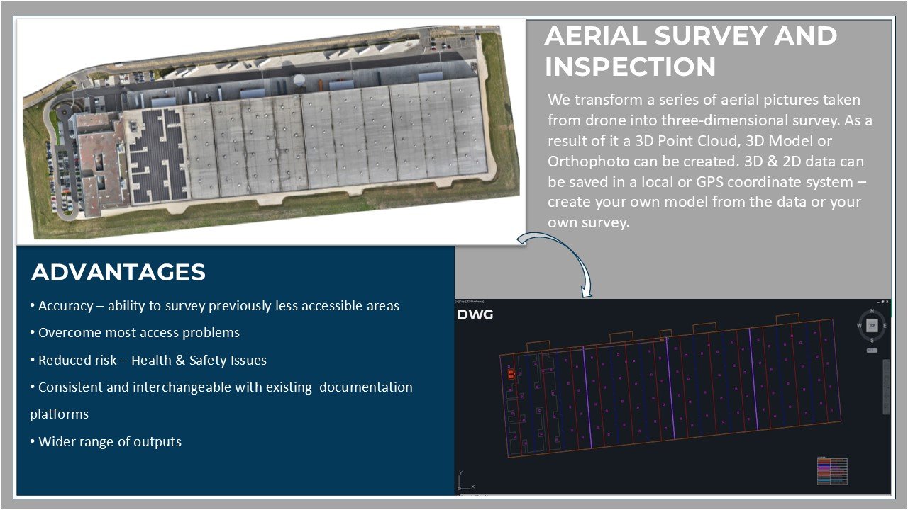
We transform a series of aerial pictures taken from drone into three-dimensional survey. As a result of it a 3D Point Cloud, 3D Model or Orthophoto can be created. 3D & 2D data can be saved in a local or GPS coordinate system – create your own model from the data or your own survey.
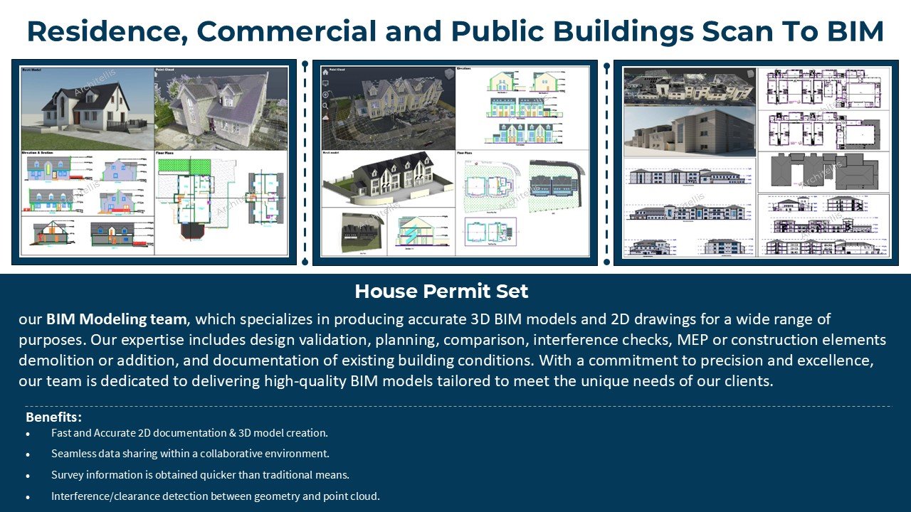
our BIM Modeling team, which specializes in producing accurate 3D BIM models and 2D drawings for a wide range of purposes. Our expertise includes design validation, planning, comparison, interference checks, MEP or construction elements demolition or addition, and documentation of existing building conditions. With a commitment to precision and excellence, our team is dedicated to delivering high-quality BIM models tailored to meet the unique needs of our clients.